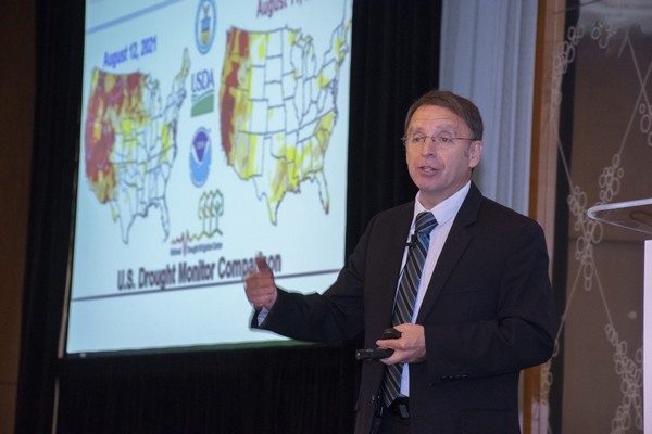
Last week, more than 200 members of the apple industry registered for a U.S. Apple webinar to find out more about what 2026 holds for apples meteorologically. Will Weather Threaten Apple Production in 2026? Drew Lerner, president and senior agricultural meteorologist of World Weather, Inc.'s gave some insights as to what the industry can expect this year.
"There are droughty conditions present across North America. All of the dryness out there is a potential issue going into summer," says Lerner.
In a normal summer, a ridge of high pressure builds up over the Rocky Mountains and part of the Plains. Meanwhile, those regions have experienced dryness as well. "This could have an impact especially on Washington and Oregon and in an indirect way on Michigan and Northeastern states," says Lerner.
 © US Apple
High pressure ridges over wet areas of the country are weak and break down frequently–it causes the soil to warm and the moisture in the soil gets lifted into the atmosphere, creating clouds, showers and thunderstorms. However a ridge over a dry area means no feedback moisture from the soil and heating up the air and ground allows the ridge to become more intense and persistent.
"We don't expect a very strong ridge of high pressure over North America. However, with the dryness in the Rocky Mountains and Great Plains, we could develop a stronger than expected ridge in June-July. That could create more heat for Washington and a cooler environment for Michigan and parts of the Northeast," he says.
In precipitation, over the last 90 days, it's been fairly limited in California, the Pacific Northwest, New England, parts of Eastern New York, Michigan and parts of the Midwest. "That sets the stage for a dryness scenario," he says.
As for cold temperatures, bloom and moisture, Lerner breaks it down:
Pacific Northwest
"There's a frost-freeze event in Washington and a cold surge that's working its way across the country and impacting the Great Lakes region this weekend, and the Northeastern states early next week," he says.
In the last few weeks in the PNW, some drought-like conditions have developed and the lack of precipitation is a concern.
In terms of snow, one interesting phenomenon that has occurred this season is how quickly the snow disappeared in the western U.S. "Though the precipitation over the winter hasn't been that far off from normal. So where is all the snow? It's not there because we had such a warm winter," notes Lerner.
 © US Apple
Because the significant amount of snow that did fall melted so quickly, reservoirs in the Yakima basin are very close to full capacity–something that doesn't happen that often this early in the season. "Last year at this time, the reservoirs were running 30-40 percent. The water supply is looking really good. As long as we can avoid a persistent hot summer, we should be okay," notes Lerner.
Washington is in the bloom now and the cold last week warranted some growers to break out cold mitigation methods such as wind machines to keep temperatures up. "The heart of the Yakima production area I think will get by as far as avoiding a more serious situation," says Lerner.
California
"Reservoirs in California are also in great shape," says Lerner. "The snow pack in the mountains isn't what it ought to be and we could be in a mess a year from now but for 2026 growing season, we'll be okay on the water supply."
Pennsylvania/Virginia
Of course, cold temperatures are always a concern during bloom and most of the bloom occurring right now is in Pennsylvania and southward through Virginia. Lerner flags concerns over regions in Pennsylvania/neighboring areas because temperatures are set to go below freezing and into the 20s.
"The green tip of the bud is beginning to show across many areas in New York as well as northern Pennsylvania," says Lerner. "If we can just get this cold air in here as quickly as possible we can probably avoid an issue for that region because the budding isn't that far advanced and it'll be able to withstand the cold. We are in the bloom at this point or certainly solid in the pink."
Michigan
When it comes to bloom concerns, Lerner flags West-central and the Southwest part of Michigan as areas to be on watch. "That's where the crop is most advanced. We are going to see some pretty chilly temperatures coming up here for Michigan," he says, though noting that the Southwest will likely be cushioned from the cold thanks to the higher humidity via Lake Michigan. "I expect a few pockets in the interior south of Michigan might be where it gets cold enough to be an issue but I don't think Michigan's got a lot to deal with."
Northeast
"Drought conditions here are mostly in New England. Most key production areas are in fairly good shape," says Lerner.
Following much of the snow melt in this region, the water supply situation is complex. "The further north you are in the production region, the better the water supply is and the better the soil moisture is. We do expect precipitation to come back into these areas periodically," says Lerner.
On bloom, it's not as advanced in southern New York state and cold temperatures in the upper 20s is likely manageable.
Wind flow patterns
"Over the next few weeks they will still have an influence on our weather, especially in the eastern part of the US," says Lerner, noting that over the winter, a ridge of high pressure dominated a large part of Western Canada and portions of the Pacific Northwest.
 © US Apple
"At the same time we had this flow pattern in the Eastern part of the country where the Arctic air was working its way into the Eastern part of the country. This pattern dominated November through February," he says.
However two major cold surges were notable, including the one January 31-February 2 that impacted growing in Florida. "I believe this pattern is repeating at a 45 day interval. It may return again and if it does, it may show up in late April or early May, which suggests that we could still see yet another round of cold weather in the Northeast in a couple of weeks," he says, adding that it's not likely to be as intense given the time of year that would take place. "However, I would not be surprised to see another risk of frost in the Northeast–in New York, parts of New England, maybe northern Pennsylvania and maybe a few counties in Michigan at some point in early May."
What is also concerning is that these cold temperatures will follow warmer ones in the Northeast–temperatures that have stimulated more bloom development and making the blooms more vulnerable to the cold.
In the West, it's likely done with frost and freezes and the next time cool air comes around, it will be mid-May so temperatures won't be able to get as low.
Upcoming precipitation
"In April through June, all of this wet weather in April should shift Northwestward. Michigan is still going to be in the thick of moisture but the greatest anomaly will be more of the upper Midwest," says Lerner.
There will be some relief in precipitation in the Northeast in May and June but the more droughty regions aren't expected to expand.
"Washington is going to continue to be dry biased. We expect temperatures to be pretty warm in the Rocky Mountain region and some of that warmth will creep into the Eastern part of the Yakima basin. The ridge should develop in late May or early June and we'll know a lot more about how it's oriented then," he says.
Summer outlook
"For the summer, we're still going to see a drier tendency in the PNW. That irrigation supply that's above normal for Washington and California will be important. If we can avoid excessive persistent heat, we'll be okay," says Lerner.
In the Northeast? It's set to have a milder summer. "Temperatures will be closer to normal than not, but there will be Northwesterly winds that will blow in periodically," he says. "Precipitation will be mixed. New York, Pennsylvania and Ohio will see a bit less precipitation relative to normal than Michigan. Michigan will still see a regular occurrence of rain."
To find out more about Lerner's weather webinar, click here.
 For more information:
Lynsee Gibbons
US Apple Association
[email protected]
www.usapple.org