New Japanese GPS satellites could enhance unmanned farming capabilities
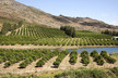
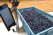
A new network of Japanese satellites over the Asia Pacific region promises to provide a global positioning system (GPS) style technology capable of driving unmanned tractors and harvesters, guiding long-flight drones over crops and grazing properties and assisting decision making calculations.
By 2023 the satellite constellation providing geospatial and information algorithms to the region will expand from the current two spacecraft to seven, making it a powerful shared resource for a host of industries, including farming.
Hitachi is already working with agricultural machinery makers and their existing auto steer technology ahead of releasing its first stage QZSS guidance systems in Australia next April.
Latest tests on NSW irrigation farms and Queensland cane fields near Mackay have achieved tracking accuracy down to about two centimetres and maintained harvest height accuracy to eight centimetres.
The company is also promising unmanned drones will be able to fly for several hours, identifying and spot spraying woody weeds, or monitoring pasture biomass on pastoral properties on a daily basis.
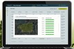
While still relatively coy about the specific costs involved, the tech giant sees big opportunities to enhance farm management and agriculture supply chain efficiency.
Read more at goodfruitandvegetables.com.au