$15.3m open source satellite data program to aid AU farmers
Developed by Geoscience Australia in coordination with the CSIRO and the National Computational Infrastructure, the project will for the first time provide open access to three decades of historical satellite data captured every two weeks at 25-metre squared resolution, with future images to provide detail down to every 10 square metres of Australia updated every five days.
The project will offer datasets including the normalised difference vegetation index and fractional cover to help paint a picture of changes to vegetation, an intertidal extents model that provides a picture of changes to tidal patterns and coastlines, and water observations from space that monitor rivers, lakes, dams and flooding.
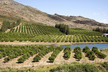
Geoscience Australia’s environmental geoscience division chief, Dr Stuart Minchin, says that agriculture would particularly benefit from world-leading landscape monitoring capabilities, citing the popularity of the technology in an Australia-wide trial.
Read more at theguardian.com