Satellites to boost productivity in water-scarce countries in Africa
WaPOR was presented this week during a high-level partners meeting for the FAO's 'Coping with water scarcity in agriculture: a global framework for action in a changing climate'. It allows for fine-grained analysis of water utilised through farming systems, generating empirical evidence about how it can be most productively used.
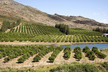
Worldwide water utilization - the majority of which is used by agriculture - has outpaced the rate of population growth for most of the last century and some regions are close to breaching viable limits.
WaPOR sifts through satellite data and uses Google Earth computing power to produce maps that show how much biomass and yield is produced per cubic meter of water consumed. The maps can be rendered at resolutions of as little as 30 to 250 meters, and updated every one to ten days.
FAO's team of information technology and land and water officers has designed WaPOR - through a $10 million project funded by the Government of the Netherlands - to cover Africa and the Near East, with a focus on key countries that are, or are projected soon, to face physical or infrastructural water scarcity.
source: allafrica.com