Australia is emerging from an unpredictable winter and heading into a spring that the Bureau of Meteorology forecasts will be wetter and warmer than usual.
Winter 2025 conditions
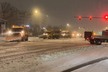
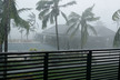
Winter brought contrasting extremes across the country. Victoria recorded above-average bushfire risk in Gippsland and other regions following a hot, dry autumn. South Australia and Tasmania were also unusually dry. Perth experienced one of its wettest winters in almost three decades, with repeated cold fronts pushing rainfall totals close to records set in 1996. Wind gusts broke a 35-year record at Jandakot, while storms cut power and damaged infrastructure.
Snowfields in the southeast saw heavy variability, with record-breaking falls in early August, the highest since the mid-1980s. Queensland recorded its first snowfall in decades as snow levels dropped to 800 meters in parts of New South Wales and Victoria.
Spring 2025 forecast
The Bureau expects above-average rainfall across eastern and central Australia, with October showing the strongest signal for heavy downpours. From September to November, northern Australia will shift from the dry to the wet season, while southern Western Australia is forecast to remain drier than normal.
Temperatures are projected to be above average almost nationwide, except in southern WA. Daytime highs are expected across northern, western, and southeastern areas, with the far north and southeast carrying a higher risk of unusually hot days. Overnight temperatures are forecast to remain above average across most of the country, particularly in northern, eastern, and central regions. The Bureau notes this combination could increase heat stress for agricultural areas, adjusting to seasonal changes.
Streamflow forecasts from August to October point to near-median to high flows across most rivers and catchments, with a few pockets of lower flows in the south.
Climate drivers
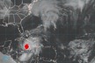
Several climate drivers are shaping the outlook. Sea surface temperatures in the Australian region were +0.56°C above average in July, the warmest in 125 years, with warmer waters around the Coral Sea and southern coasts expected to fuel storms. Globally, July 2025 was the third-warmest on record.
The El Niño–Southern Oscillation is neutral and likely to remain so until January, though some models indicate borderline La Niña conditions could develop briefly during spring. The Indian Ocean Dipole has shifted into a negative phase, typically linked with higher rainfall in Australia, and is expected to persist into spring before returning to neutral in early summer.
Source: News.com