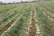
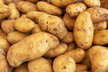
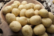
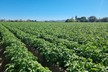
There are many initiatives for precision agriculture. The Belgian potato sector will start using satellite images next year. “We have been busy with this project ‘Watch iT Grow’ for a while now, and in the beginning of February 2017, we will introduce a new app,” says Isabelle Piccard of VITO Remote Sensing, one of the participating organizations. Together with Belgapom, Cra-w, and the University of Liege, they have been working on an application that uses satellite images combined with ground measurements and climate information. “This way potato producers can, in an independent, easy, and quick manner, follow the growth and development of his/her potato production efficiently, and predict the yield earlier in the season. With this we show the possibilities for potatoes, but this can be developed for other products as well.”
First year is free
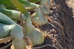
“During the first year, potato producers can participate for free, because we have several producers. Every producer has his own potato field or multiple fields. With help of satellite images, they can precisely see what is happening out on the fields. The images can be combined with weather data and it is possible to zoom in on the plants. The information that the producer receives can be used to make targeted decisions about his plants. Because they are able to switch very swiftly, his yearly net yield could be higher. The revenue model is made up of all the information that is supplied, including samples of various producers.”
“Researchers from Flanders and Walloon have created a web-based geographic information platform, with financial support of BELSPO (Belgian Science Policy) and together with the potato market and processing industry. All available information concerning potato production will be brought together in this platform and can be supplemented continuously. The data in the app is gathered from ground measurements, observations from the air (with help of drones), and observations from space (satellites). The application can be expanded with other data.”
Isabelle Piccard of VITO Remote Sensing during Interpom Primeurs in front of the satellite.
Watch iT Grow will be officially launched at the beginning of 2017 at www.watchitgrow.be
For more information about the platform, you can contact Jürgen Decloedt (VITO Remote Sensing – [email protected]).
For general information about the project, you can contact Romain Cools (Belgapom – [email protected]).