Hurricane Erin is currently a sprawling Category 4 storm churning in the Atlantic. It is expected to strengthen throughout the day and will remain large and dangerous through the middle of this week. Erin is expected to move between Bermuda and the east coast of the United States by the middle of this week.
While it is expected to stay off the U.S. east coast, the system is forecast to bring life-threatening surf and rip currents as well as coastal flooding between August 19 and 21.
See the projected path of hurricane Erin below.
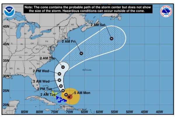 © National Hurricane Center
Source: National Hurricane Center