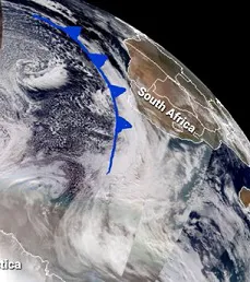
 Two "mammoth" cold fronts coming from the South Pole are bearing down on the southern tip of Africa, one making landfall yesterday and another low pressure system not far behind, bringing gale force winds, heavy rain as well as snow as deep inland as the Northern Cape and the mountains of Lesotho.
Right: satellite image taken by Nasa's Joint Polar Satellite System. Antarctica is at bottom left
The turbulent weather is heading up the coast towards Port Elizabeth and Durban. The South African Weather Service has warned that medium to large vessels may be at risk as a result of the dragging of anchors.
Durban and Cape Town harbours were windbound yesterday for 18 hours and 16 hours respectively. Ngqura Harbour is windbound with a high possibility that Cape Town could be windbound this evening.
Conditions at the harbours are tough at the moment because of the weather, a shipper says.
There have been a number of trucks blown over due to gale force winds.
On the other hand, snowfall on the mountains is excellent for cold unit accumulation and the replenishment of subterranean water reserves.
In the West Cape rain started yesterday morning and it has been continuing unabated, a welcome return to the kind of days-long winter rainfall to which the Cape has always been used. Rain is expected to continue until next Tuesday.
Kirstenbosch had 125 mm by this morning, Wellington measured 55mm.
Meanwhile, the national electricity provider has warned of an increased possibility of power outages today.
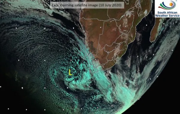 Satellite image from the South African Weather Service